

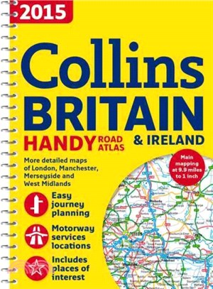
Collins Handy Road Atlas Britain 2015
- 系列名:Collins Handy Road Atlas Britain
- ISBN13:9780007555109
- 出版社:Trafalgar Square Books
- 作者:Collins Maps (COR)
- 裝訂/頁數:平裝/180頁
- 規格:21.6cm*15.2cm (高/寬)
- 出版日:2014/09/01
商品簡介
A handy A5-sized road atlas with popular lie-flat spiral binding and extremely clear route planning maps of Britain and Ireland
This detailed atlas fits neatly into a glove box, briefcase, or bag, and features maps of Britain at 9.9 miles to one inch (1:625,000) and the whole of Ireland at 15.8 miles to one inch (1:1,000,000). There are also a selection of more detailed urban area maps at 4.5 miles to one inch (1:285,000) to aid route planning in these busy areas. It also includes a national rail map, Park & Ride locations (for bus and rail), a handy distance calculator chart highlighting distances between the major towns, and money-off vouchers from Castle Cover Insurance.
作者簡介


您曾經瀏覽過的商品

購物須知
外文書商品之書封,為出版社提供之樣本。實際出貨商品,以出版社所提供之現有版本為主。部份書籍,因出版社供應狀況特殊,匯率將依實際狀況做調整。
無庫存之商品,在您完成訂單程序之後,將以空運的方式為你下單調貨。為了縮短等待的時間,建議您將外文書與其他商品分開下單,以獲得最快的取貨速度,平均調貨時間為1~2個月。
為了保護您的權益,「三民網路書店」提供會員七日商品鑑賞期(收到商品為起始日)。
若要辦理退貨,請在商品鑑賞期內寄回,且商品必須是全新狀態與完整包裝(商品、附件、發票、隨貨贈品等)否則恕不接受退貨。