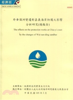
外傘頂洲變遷對嘉義海岸防護之影響分析研究(總報告)
- ISBN13:9789860480818
- 出版社:經濟部水利署第五河川局
- 作者:財團法人成大水利海洋研究發展文教基金會
- 裝訂/頁數:平裝/288頁
- 規格:30cm*21cm (高/寬)
- 出版日:2016/02/01
再享89折,單本省下94元
商品簡介
本計畫工作範圍為台子村(外傘頂洲北側3公里)至北門(急水溪口南側1公里),沿岸長度約34公里。計畫分兩年度辦理,其目的希冀藉由海岸之基本資料蒐集分析、沿岸防護工分佈、計畫區海岸地形水深變遷特性分析及海岸波場模擬,檢討外傘頂洲變遷對沿線海堤安全性影響及既有設施因應改善對策,以作為未來本段海岸防護規劃與設計之應用參考。 依工作項目訂定,進行潮位、波浪、流況、砂灘及底床質粒徑、河川水文、地層下陷及外傘頂洲變遷研究文獻等資料蒐集。並由往昔水深地形監測資料,分析計畫區海岸地形變遷。 外傘頂洲地形變遷分析方面,歸納說明外傘頂洲海岸線及面積變化情形,再由自然力及人為因素兩方面分析外傘頂洲變遷的特性。分析結果顯示近二十年外傘頂洲仍持續向南及向東漂移。若砂洲面積縮小趨勢不變,於2028年以後砂洲高度將沒入EL.0m以下。 外傘頂洲變遷對計畫區海域波場影響方面,以NNW、WNW、W、WSW、SW及SSW六組颱風波向做模擬。模擬結果繪製成波場分佈圖、現況地形與外傘頂洲高度降低後之波高差異圖、各堤段堤前波高斷面圖。分析結果顯示波浪由北方入射時(如NNW波向、WNW波向),因波向與外傘頂洲走向大至呈垂直,遮蔽區範圍較大,外傘頂洲高度降低對波高之影響至白水湖海堤段。波浪由南方入射時(如SW波向、SSW波向),因波向與外傘頂洲走向大至呈平行,遮蔽區範圍縮小,對波高之影響至東石海埔地事業堤段。 外傘頂洲變遷對沿線海堤安全性影響方面,依據相關水理推估方法及經驗公式,由波場模擬結果分析海堤之安全性,推算波浪溯上高、越波量、堤趾基礎安定大小等項目。各堤段之波浪溯上計算結果,在50年重現期颱風波浪條件作用下,現況地形時各堤段皆無堤後越波情形發生。若增加考量水位抬升、外傘頂洲高度降低、地層下陷等條件下,於鰲鼓海埔地事業堤及東石海埔地事業堤會發生越波情形,但其越波量尚在安全標準內。 既有設施因應改善對策方面,依海堤波浪溯上與越波量分析結果,評估海岸結構物現況,再提出具體之海堤改善方案。改善構想為抑制波浪溯上及堤前消波工調整,共提出複式平台及複式緩坡兩種方案。 外傘頂洲灘線現地踏勘部分,為瞭解砂洲於低水位時段之砂灘分佈,及高水位條件下,砂洲低灘受波浪作用之情形,邀請水利署、審查委員、第五河川局、相關機關等專家辦理現勘行程。於2014年5月21日低水位時段、2015年6月17日高水位時段完成外傘頂洲現地踏勘。
This project investigated the coastal area between Taizi Village (3km north of Wai-san-ding sandbar) and Beimen(1km south of the mouth of JiShui Stream), whose length is about 34km. For two-years, this project collected and analyzed coastal information, investigated the distribution of coastal protection engineering works, ran coastal wave field simulation, assessed the effect of changing Wai-san-ding sandbar on seawall safety and formed strategy of improving current seawalls to provide necessary information for planning and designing coastal protection in the future.
The scheduled data collection included collection of research literature of tide level, wave, current condition, beach and bottom sediment diameter, river hydrology, land subsidence and Wai-san-ding sandbar change. The topographic change in the investigated ambit was analyzed by examining past bathymetric and topographic survey data.
For analyzing topographic change of Wai-san-ding sandbar, this project explained the shoreline and area change of Wai-san-ding sandbar summarily and examined natural and human causes of Wai-san-ding sandbar change. The investigating results show that Wai-san-ding sandbar drifted continuously to south and east in the last twenty years. If the sandbar area kept decreasing, the level of the sandbar will become smaller than EL. 0m in 2028.
For presenting the effect of changing Wai-san-ding sandbar on the oceanic wave field in the investigated ambit. In addition to the simulations of wave directions NNW, WNW, W ,WSW, SW and SSW during typhoon. The simulation results were used in drawing wave field distribution map, the map of wave level difference between current topography and abated Wai-san-ding sandbar and the cross-section map of wave level in front of seawall for every seawall part. The investigation results showed that in the case of northern wave directions (NNW and WNW), the effect of abating Wai-san-ding sandbar on wave level reached Baishuihu seawall because the wave directions almost vertical to Wai-san-ding sandbar leads to increase of sheltered area; in the case of southern wave directions (like SW and SSW), the effect of abating Wai-san-ding sandbar on wave level reached Dongshih seawall because the wave directions almost horizontal to Wai-san-ding sandbar leads to decrease of sheltered area.
With the corresponding hydrologic estimation method and empirical equations, the simulation results were used to evaluate seawall safety like wave runup level, wave overtopping rate and revetment block stable weight. In the condition of typhoon wave of 50 year recurrence year period, every seawall part of current topography showed no wave runup. In the case of risen water level and abating Wai-san-ding sandbar, wave runup occurs on the seawall of Aogu tidal flat and the seawall of Dongshih tidal flat. But the wave runup was still within safety margin.
The stability and disaster prevention capability of current coastal structure in the case of risen water level and abating Wai-san-ding sandbar were estimated by analyze possible wave runup level and wave overtopping rate. For the investigated ambit, seawall improvement plans were proposed. The plans focused on improving front slope of seawall and included plans of duplex bands and duplex gradual slopes.
The purpose of in-situ survey was to investigate the wave effect on sandbar low beach and overall beach distribution of Wai-san-ding sandbar on high water level. The in-situ surveys of this project were performed at low water level time of May 21, 2014 and June 17, 2015 and by 34 experts including officials of Water Resource Agency and Fifth River Management Office, inspection committee members and members of other related agencies.
主題書展
更多主題書展
更多書展本週66折
您曾經瀏覽過的商品
購物須知
為了保護您的權益,「三民網路書店」提供會員七日商品鑑賞期(收到商品為起始日)。
若要辦理退貨,請在商品鑑賞期內寄回,且商品必須是全新狀態與完整包裝(商品、附件、發票、隨貨贈品等)否則恕不接受退貨。


