‧ Waterproof ‧ Tear-Resistant ‧ Travel MapNational Geographic's Four Corners Region DestinationMap strikes the perfect balance between map and guidebook and is ideal for a wide range of travelers. The
‧ Waterproof ‧ Tear-Resistant ‧ Topographic MapCoverage includes White River and San Isabel national forests; Hunter-Fryingpan and Holy Cross wilderness areas; Sylvan Lake State recreation area; and t
• Waterproof • Tear-Resistant • Topographic MapThis Trails Illustrated topographic map for Virgin Islands National Park, and surrounding area on the island of St. John, US Virgin Islands. The map incl
‧ Waterproof ‧ Tear-Resistant ‧ Topographic MapCoverage includes San Juan and Rio Grande national forests; Weminuche Wilderness; Williams Creek; Big Meadows and Rio Grand reservoirs; Chicago Basin, Em
‧ Waterproof ‧ Tear-Resistant ‧ Topographic MapNational Geographic's Trails Illustrated map of Mount Tamalpais and Point Reyes is a two-sided, waterproof map designed to meet the needs of outdoor enth
‧ Waterproof ‧ Tear-Resistant ‧ Travel MapNational Geographic's Finland and Northern Scandinavia AdventureMap is designed to meet the unique needs of adventure travelers with its durability and accura
‧ Waterproof ‧ Tear-Resistant ‧ Travel MapNational Geographic's Sardinia AdventureMap is designed to meet the unique needs of adventure travelers with its durability and accurate information. This fol
‧ Waterproof ‧ Tear-Resistant ‧ Travel MapNational Geographic's Caribbean DestinationMap strikes the perfect balance between map and guidebook and is ideal for a wide range of travelers. The map inclu
‧ Waterproof ‧ Tear-Resistant ‧ Travel MapNational Geographic's Austrailia AdventureMap is designed to meet the unique needs of adventure travelers with its durability and accurate information. This f
‧ Waterproof ‧ Tear-Resistant ‧ Topographic MapCoverage area includes: White Mountain National Forest, Mt Washington, Tuckerman Ravine and Pinkham Notch, Dry RiverAPresidential Range; Great Gulf, and
‧ Waterproof ‧ Tear-Resistant ‧ Travel MapExplore the exhilarating majesty and mystique of Southeast Alaska with National Geographic's Alaska's Inside Passage DestinationMap. The Inside Passage is a m
‧ Waterproof ‧ Tear-Resistant ‧ Travel MapNational Geographic's South Africa AdventureMap is designed to meet the unique needs of adventure travelers with its durability and accurate information. This
‧ Waterproof ‧ Tear-Resistant ‧ Travel MapNational Geographic's Pyrenees and Andorra AdventureMap is designed to meet the unique needs of adventure travelers with its durability and accurate informati
‧ Waterproof ‧ Tear-Resistant ‧ Travel MapNational Geographic's India, Northwest AdventureMap is designed to meet the unique needs of adventure travelers with its durability and accurate information.
‧ Waterproof ‧ Tear-Resistant ‧ Travel MapThe front side is an easy-to-read road map with insets of: - Portland - Bangor - Lewiston / Auburn - Augusta The back includes: - Maps and information for Por
‧ Waterproof ‧ Tear-Resistant ‧ Topographic MapCoverage area includes White Mountain National Forest; Pemigewasset and Sandwich Range wilderness areas; Appalachian National Scenic Trail from Hanover,
‧ Waterproof ‧ Tear-Resistant ‧ Travel MapNational Geographic's Southern Norway and Sweden AdventureMap is designed to meet the unique needs of adventure travelers with its durability and accurate inf
‧ Waterproof ‧ Tear-Resistant ‧ Travel MapNational Geographic's India, Northeast AdventureMap is designed to meet the unique needs of adventure travelers with its durability and accurate information.
‧ Waterproof ‧ Tear-Resistant ‧ Travel MapNational Geographic's India, South AdventureMap is designed to meet the unique needs of adventure travelers with its durability and accurate information. This
‧ Waterproof ‧ Tear-Resistant ‧ Travel MapNational Geographic's Thailand AdventureMap is designed to meet the unique needs of adventure travelers with its durability and accurate information. This fol
‧ Waterproof ‧ Tear-Resistant ‧ Travel MapOur up-to-date, detailed road map and travel guide to Washington State. The main map features Washington's highways, toll roads, rest areas, interstates, majo
‧ Waterproof ‧ Tear-Resistant ‧ Topographic MapThis title provides an increased scale of one of the most visited National Parks in the US, and one of our more popular map titles. This increased scale
• Waterproof • Tear-Resistant • Topographic MapCoverage includes Gunnison National Forest; West Elk and Raggeds wilderness areas; Paonia State Recreation Area; the city of Somerset; Beaver Reservoir,
‧ Waterproof ‧ Tear-Resistant ‧ Topographic MapCoverage includes White River and Gunnison national forests; Maroon Bells-Snowmass and Collegiate Peaks Wilderness areas; the cities of Gothic, Crested B
‧ Waterproof ‧ Tear-Resistant ‧ Topographic MapCoverage area includes parts of San Juan and Uncompahgre national forests; south San Juan Mountains; Lizard Head, Mt Sneffels and Uncompahgre wilderness
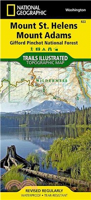
‧ Waterproof ‧ Tear-Resistant ‧ Topographic MapGifford- National Forest ‧ Washington, USAOne of five new Trails Illustrated maps for the Washington Cascades region offers the most detailed and up-to-d
‧ Waterproof ‧ Tear-Resistant ‧ Travel MapIn addition to the easy-to-read map on the front, the back includes: - Regional map - Points of interest - Inset map of Mitte - U-Bahn and S-Bahn public trans
‧ Waterproof ‧ Tear-Resistant ‧ Travel MapNational Geographic's Costa Rica AdventureMap is designed to meet the unique needs of adventure travelers with its durability and accurate information. This f
‧ Waterproof ‧ Tear-Resistant ‧ Topographic MapThis title provides an increased scale of one of the most visited National Parks in the US, and one of our more popular map titles. This increased scale
‧ Waterproof ‧ Tear-Resistant ‧ Topographic MapMount Baker-Snoqualmie and Okanogan-Wenatchee National Forests · Washington, USAOne of five new Trails Illustrated maps for the Washington Cascades regio
‧ Waterproof ‧ Tear-Resistant ‧ Topographic MapCoverage includes Gunnison National Forest, and the cities of Gunnison, Almont, Pitkin, Ohio, and Parlin; East, Gunnison. and Taylor rivers; Gold and Tom
‧ Waterproof ‧ Tear-Resistant ‧ Topographic MapGifford-Pinchot and Okanogan-Wenatchee National Forests ‧ Washington, USAOne of five new Trails Illustrated maps for the Washington Cascades region offer
‧ Waterproof ‧ Tear-Resistant ‧ Topographic MapGrand Canyon West (#263) and Grand Canyon East (#262) combine to cover the entire Grand Canyon National Park and its bordering public lands. Both maps co
‧ Waterproof ‧ Tear-Resistant ‧ Topographic MapGrand Canyon, Bright Angel Canyon/North and South Rims (#261) replaces the previous Grand Canyon National Park Trails Illustrated map (#207). Completely
‧ Waterproof ‧ Tear-Resistant ‧ Topographic MapCovering all of Zion National Park, our Trails Illustrated map contains detailed topography with shaded relief, up-to-date trails, roads, and points of i
‧ Waterproof ‧ Tear-Resistant ‧ Topographic MapWithin the park, there is detailed coverage of Mount Rainier and its many glaciers, Eagles Roost, Cataract Valley, Mystic, Emmons Overlook, Indian Bar, M
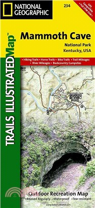
‧ Waterproof ‧ Tear-Resistant ‧ Topographic MapTopographic map for Mammoth Cave, and surrounding area in west-central Kentucky covers the area in and around the cave.The map includes the Green River,