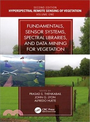
Fundamentals, Sensor Systems, Spectral Libraries, and Data Mining for Vegetation
商品資訊
系列名:Hyperspectral Remote Sensing of Vegetation
ISBN13:9781138058545
出版社:CRC Pr I Llc
作者:Prasad S. Thenkabail (EDT); John G. Lyon (EDT); Alfredo Huete (EDT)
出版日:2018/12/07
裝訂/頁數:精裝/449頁
規格:26cm*18.4cm*3.2cm (高/寬/厚)
版次:2
商品簡介
Written by leading global experts, including pioneers in the field, the four-volume set on Hyperspectral Remote Sensing of Vegetation, Second Edition, reviews existing state-of-the-art knowledge, highlights advances made in different areas, and provides guidance for the appropriate use of hyperspectral data in the study and management of agricultural crops and natural vegetation.
Volume I, Fundamentals, Sensor Systems, Spectral Libraries, and Data Mining for Vegetation introduces the fundamentals of hyperspectral or imaging spectroscopy data, including hyperspectral data processes, sensor systems, spectral libraries, and data mining and analysis, covering both the strengths and limitations of these topics. This book also presents and discusses hyperspectral narrowband data acquired in numerous unique spectral bands in the entire length of the spectrum from various ground-based, airborne, and spaceborne platforms. The concluding chapter provides readers with useful guidance on the highlights and essence of Volume I through the editors’ perspective.
Key Features of Volume I:
- Provides the fundamentals of hyperspectral remote sensing used in agricultural crops and vegetation studies.
- Discusses the latest advances in hyperspectral remote sensing of ecosystems and croplands.
- Develops online hyperspectral libraries, proximal sensing and phenotyping for understanding, modeling, mapping, and monitoring crop and vegetation traits.
- Implements reflectance spectroscopy of soils and vegetation.
- Enumerates hyperspectral data mining and data processing methods, approaches, and machine learning algorithms.
- Explores methods and approaches for data mining and overcoming data redundancy;
- Highlights the advanced methods for hyperspectral data processing steps by developing or implementing appropriate algorithms and coding the same for processing on a cloud computing platform like the Google Earth Engine.
- Integrates hyperspectral with other data, such as the LiDAR data, in the study of vegetation.
- Includes best global expertise on hyperspectral remote sensing of agriculture, crop water use, plant species detection, crop productivity and water productivity mapping, and modeling.
作者簡介
Dr. Prasad S. Thenkabail, Research Geographer-15, U.S. Geological Survey (USGS), is a world-recognized expert in remote sensing science with multiple major contributions in the field sustained over more than 30 years. He obtained his PhD from the Ohio State University in 1992 and has over 140+ peer-reviewed scientific publications. Dr. Thenkabail has conducted pioneering cutting-edge research in the area of hyperspectral remote sensing of vegetation (https://www.usgs.gov/wgsc/GHISA/) and in that of global croplands and their water use for food security (www.croplands.org). Dr. Thenkabail’s contributions to series of leading edited books on remote sensing science along with his research and other contributions in the subject places his as a noted global expert in remote sensing science. He edited three-volume book entitled Remote Sensing Handbook published by Taylor and Francis, with 82 chapters and more than 2000 pages, widely considered a "magnus opus" encyclopedic standard reference for students, scholars, practitioners, and major experts in remote sensing science. He has recently completed editing four-volume Hyperspectral Remote Sensing of Vegetation. He has also edited a book on Remote Sensing of Global Croplands for Food Security. He is currently an editor-in-chief of the Remote Sensing open access journal published by MDPI; an associate editor of the journal Photogrammetric Engineering and Remote Sensing (PERS) of the American Society of Photogrammetry and Remote Sensing (ASPRS); and an editorial advisory board member of the International Society of Photogrammetry and Remote Sensing (ISPRS) Journal of Photogrammetry and Remote Sensing. NASA and USGS selected him on the Landsat Science team (2007-2011). Earlier, he served on the editorial board of Remote Sensing of Environment for many years (2007–2017). He has won three best paper awards from ASPRS for his publications in PE&RS. Detailed bio of Dr. Thenkabail can be found here: https://www.usgs.gov/staff-profiles/prasad-thenkabail
John G. Lyon has conducted scientific and engineering research and administrative functions throughout his career. He is formerly the senior physical scientist in the U.S. Environmental Protection Agency’s Office of Research and Development (ORD) and Office of the Science Advisor in Washington, DC, where he co-led work on the Group on Earth Observations and the USGEO subcommittee of the Committee on Environment and Natural Resources, and research on geospatial issues. Lyon was director of ORD’s Environmental Sciences Division for approximately eight years. He was educated at Reed College in Portland, Oregon, and the University of Michigan in Ann Arbor.
Professor Alfredo Huete leads the Ecosystem Dynamics Health and Resilience research program within the Climate Change Cluster (C3) at the University of Technology Sydney, Australia. His main research interest is in using remote sensing to study and analyze broad scale vegetation health and functioning. Recently, he used remote sensing and field measurements to understand the phenology patterns of tropical rainforests and savannas in the Amazon and Southeast Asia and his Amazon work was featured in a National Geographic television special entitled "The Big Picture". Currently his research involves coupling eddy covariance tower flux measurements with ground spectral sensors and satellite observations to study carbon and water cycling across Australian landscapes. He is actively involved with several international space programs, including the NASA-EOS MODIS Science Team, the Japanese JAXA GCOM-SGLI Science Team, the European PROBA-V User Expert Group, and NPOESS-VIIRS advisory group.
主題書展
更多書展購物須知
外文書商品之書封,為出版社提供之樣本。實際出貨商品,以出版社所提供之現有版本為主。部份書籍,因出版社供應狀況特殊,匯率將依實際狀況做調整。
無庫存之商品,在您完成訂單程序之後,將以空運的方式為你下單調貨。為了縮短等待的時間,建議您將外文書與其他商品分開下單,以獲得最快的取貨速度,平均調貨時間為1~2個月。
為了保護您的權益,「三民網路書店」提供會員七日商品鑑賞期(收到商品為起始日)。
若要辦理退貨,請在商品鑑賞期內寄回,且商品必須是全新狀態與完整包裝(商品、附件、發票、隨貨贈品等)否則恕不接受退貨。


