


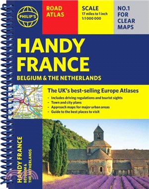
Philip''s Handy Road Atlas of France, Belgium and The Netherlands features new digital cartography voted Britain''s clearest and most detailed European mapping in an independent consumer survey. This glove-box size, compact A5 atlas with lie-flat binding is perfect for travelling across France and the surrounding countries.
Philip''s Road Atlas France, Belgium and The Netherlands shows the national road networks at a scale of 1:1 million, with ultra-clear, detailed mapping for urban areas. All the scenic routes are clearly highlighted, and the maps show huge numbers of places to visit including beaches, theme parks, national parks and World Heritage Sites.
Alongside the easy-to-read, bestselling mapping is:
* Special route-planner spread
* Listings for ski resorts and top visitor attractions;
* Summary of driving regulations in France, Belgium and the Netherlands
* Pages of clear, detailed road maps, with car ferries and toll, toll-free and pre-pay motorways all clearly marked
* Large-scale approach maps for four major cities (Bordeaux, Lyon, Paris, Strasbourg) to avoid jams
* City-centre plans marking historic buildings and tourist attractions as well as car parks, head post offices and other facilities in eight major cities (Amsterdam, Brussels, Bordeaux, Luxembourg, Lyon, Marseilles, Paris, Strasbourg).
外文書商品之書封,為出版社提供之樣本。實際出貨商品,以出版社所提供之現有版本為主。部份書籍,因出版社供應狀況特殊,匯率將依實際狀況做調整。
無庫存之商品,在您完成訂單程序之後,將以空運的方式為你下單調貨。為了縮短等待的時間,建議您將外文書與其他商品分開下單,以獲得最快的取貨速度,平均調貨時間為1~2個月。
為了保護您的權益,「三民網路書店」提供會員七日商品鑑賞期(收到商品為起始日)。
若要辦理退貨,請在商品鑑賞期內寄回,且商品必須是全新狀態與完整包裝(商品、附件、發票、隨貨贈品等)否則恕不接受退貨。