Monmonier (geography, Syracuse U.) provides an understanding as well as a meteorological and scientific cartography-based history of the weather phenomenon known as lake-effect snow, in which snows fa
This book explores the US patent system, which helped practical minded innovators establish intellectual property rights and fulfill the need for achievement that motivates inventors and scholars alik
Weather maps have made our atmosphere visible, understandable, and at least moderately predictable. In Air Apparent Mark Monmonier traces debates among scientists eager to unravel the enigma of storms
Weather maps have made our atmosphere visible, understandable, and at least moderately predictable. In Air Apparent Mark Monmonier traces debates among scientists eager to unravel the enigma of storms
Maps, as we know, help us find our way around. But they're also powerful tools for someone hoping to find you. Widely available in electronic and paper formats, maps offer revealing insights into our
In Rhumb Lines and Map Wars, Mark Monmonier offers an insightful, richly illustrated account of the controversies surrounding Flemish cartographer Gerard Mercator's legacy. He takes us back to 1569,
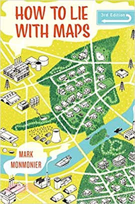
Originally published to wide acclaim, this lively, cleverly illustrated essay on the use and abuse of maps teaches us how to evaluate maps critically and promotes a healthy skepticism about these eas
No place is perfectly safe, but some places are more dangerous than others. Whether we live on a floodplain or in "Tornado Alley," near a nuclear facility or in a neighborhood poorly lit at night, we
Maps with the News is a lively assessment of the role of cartography in American journalism. Tracing the use of maps in American news reporting from the eighteenth century to the 1980s, Mark Monmonier
Writers know only too well how long it can take--and how awkward it can be--to describe spatial relationships with words alone. And while a map might not always be worth a thousand words, a good one c
No place is perfectly safe, but some places are more dangerous than others. Whether we live on a floodplain or in "Tornado Alley," near a nuclear facility or in a neighborhood poorly lit at night, we
Maps, as we know, help us find our way around. But they're also powerful tools for someone hoping to find you. Widely available in electronic and paper formats, maps offer revealing insights into our
An instant classic when first published in 1991, How to Lie with Maps revealed how the choices mapmakers make—consciously or unconsciously—mean that every map inevitably presents only one
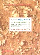
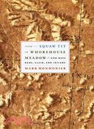
Brassiere Hills, Alaska. Mollys Nipple, Utah. Outhouse Draw, Nevada. In the early twentieth century, it was common for towns and geographical features to have salacious, bawdy, and even derogatory na
Brassiere Hills, Alaska. Mollys Nipple, Utah. Outhouse Draw, Nevada. In the early twentieth century, it was common for towns and geographical features to have salacious, bawdy, and even derogatory nam
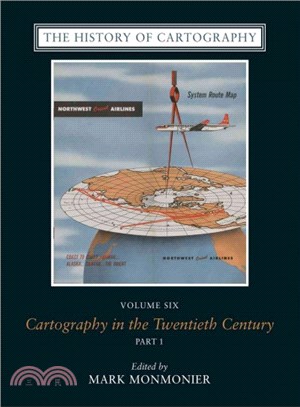
For more than thirty years, the History of Cartography Project has charted the course for scholarship on cartography, bringing together research from a variety of disciplines on the creation, dissemin