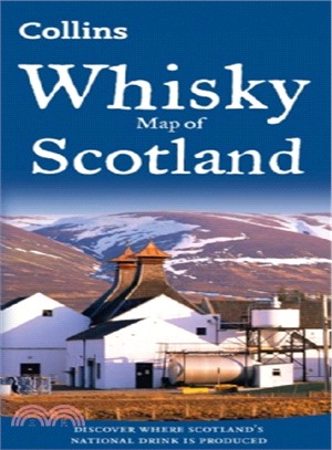
All of Scotland’s operational whisky distilleries and whisky-related places of interest located on one map. An easy-to-use index lists visitor facilities, contact details and websites.• Map of over 10
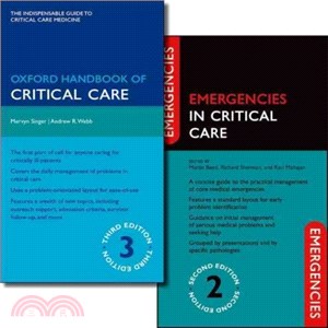
Patient-centred and practical, this pack serves the consultant, trainee, nurse, and other allied health professionals as both a reference and aide memoir. This is an indispensable pack for all those w
Michelin USA Pacific Northwest Map 171 (scale: 1:1,267,000)—part of Michelin's brand-new US regional map series with bright green covers—zooms in close for comprehensive coverage of Washington and Ore
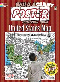
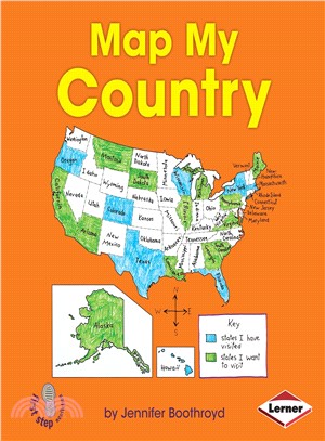
Color 24 individual pages and assemble them into a huge map! Includes state capitals and fun facts. Each unbacked page is perforated for easy removal. Complete 44 x 47? map shown on cover.
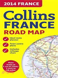
This new edition of the annually revised, politically colored map of France is the ideal map for planning and route-finding, from the Belgian and German borders in the north to the Spanish border in t
This new edition of the annually revised, politically colored map of Europe is the ideal map for planning and route-finding, from the North Cape to Gibraltar and from Ireland to east of Moscow.
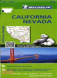
Michelin USA California, Nevada Map 174 (scale: 1:1,267,000)—part of Michelin's brand-new US regional map series with bright green covers—zooms in close for comprehensive coverage of California and Ne
Enter the frigid lands of the Pathfinder campaign setting with the Reign of Winter Poster Map Folio. Seek high adventure or map your party's explorations on three giant poster maps designed for use wi
See how a boy makes a map of his home showing fire escape routes. Simple text takes early readers step by step through the types of features a fire safety map needs to have.
Follow along as a boy makes a map of places to see on a trip to Texas. Simple text takes early readers step by step through the types of features a state map needs to have and how to find the informat
This official map of Scotland is published in association with Scotland's national tourist authority, Visit Scotland. A comprehensive map showing the locations of more than 1700 places to visit and th
This volume collects two plays by Erin Courtney, A Map of Virtue and Black Cat Lost. The Obie Award?winning Map is a symmetrical play: part interview, part comedy, part horror story. Courtney's plays
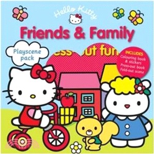
Join in the fun with this exciting playscene pack! This pack is filled with a colouring book, stickers, press-outs and a reversible playscene. Play with a press-out Hello Kitty character in two differ
‧ Waterproof ‧ Tear-Resistant ‧ Topographic MapNational Geographic's Trails Illustrated map of Skyline Boulevard Parks and Preserves is a two-sided, waterproof map designed to meet the needs of outdoo
• Waterproof • Tear-Resistant • Topographic MapNational Geographic's Trails Illustrated map of Capitol Reef National Park is a two-sided, waterproof map designed to meet the needs of outdoor enthusias
• Waterproof • Tear-Resistant • Topographic MapNational Geographic's Trails Illustrated map of Absaroka-Beartooth Wilderness West is a two-sided, waterproof, topographic trail map designed to meet the
Enjoy the accuracy and beauty of the latest world map from the cartographers at National Geographic. This map features the Winkel Tripel projection to reduce distortion of land masses as they near the
This double-sided world map commemorates the National Geographic Society's 125th Anniversary with a modern spin on a classic map design.The front side portrays a contemporary political world accompani
This elegant, richly colored antique-style world map features the incredible cartographic detail that is the trademark quality of National Geographic. The map features a Tripel Projection, which reduc
‧ Waterproof ‧ Tear-Resistant ‧ Topographic MapNational Geographic's Trails Illustrated map of Big Basin/Santa Cruz Parks and Preserves is a two-sided, waterproof map designed to meet the needs of out
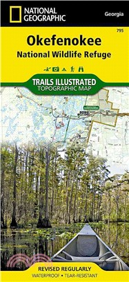
‧ Waterproof ‧ Tear-Resistant ‧ Topographic MapNational Geographic's Trails Illustrated map of Okefenokee National Wildlife Refuge is a two-sided, waterproof map designed to meet the needs of outdoor
‧ Waterproof ‧ Tear-Resistant ‧ Travel MapNational Geographic's Nepal AdventureMap is the most authoritative map for touring the country. Each waterproof and tear-resistant map provides travelers with
How To Litter-Train Your Hoarding Pack-Rats In order to maintain your sanity while living under the same roof with a hoarding pack-rat, you must come to terms with your priorities. What is most import
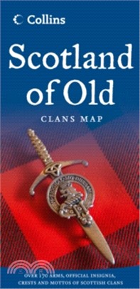
The Collins Scotland of Old Clans Map is a unique pictorial map showing the ancient territories of the principal Scottish clans in the 17th century, and features Don Pottinger's (Islay Herald of Arms)
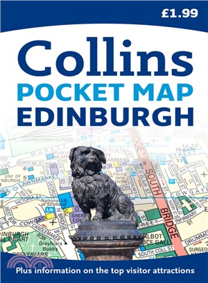
Handy pocket sized map of central Edinburgh, ideal for visitors to this beautiful city. The map is fully indexed and there is also information on some of the best places to visit, all fully cross-refe
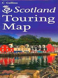
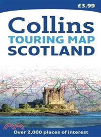
Scale: 1:316,800 (5 miles to 1 inch). This popular touring map has a huge amount of detail with places of tourist interest plotted and named on the map. Fully updated for 2010. A clear, easy to follow
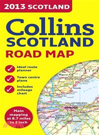
Full colour map of Scotland at 8.7 miles to 1 inch (1:550,000) with clear, detailed road network and administrative areas shown in colour. The map covers the whole of Scotland and part of Northern Eng
A revision bundle to help students pass their medical finals, this pack containsComplete Self Assessment for Medical and Surgical Finals, Second EditionComplete Revision Notes for Medical and Surgical
The Speaking Test Preparation Pack for IELTS is a comprehensive teacher resource pack from Cambridge ESOL to help teachers who are preparing students to take the IELTS Speaking test. Written by experi
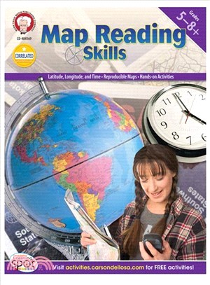
Get your GPS going with students in grades 5?8 using Map Reading Skills! The activities in this 80-page book provide students with ample opportunities to practice and apply map skills. Map and diagram
• Waterproof • Tear-Resistant • Topographic MapNational Geographic's Trails Illustrated map of Bend and Smith Rock is a two-sided, waterproof map designed to meet the needs of outdoor enthusiasts with
National Geographic's Finger Lakes DestinationMap strikes the perfect balance between map and guidebook and is an ideal resource for touring this culturally and geographically unique region of New Yor
‧ Waterproof ‧ Tear-Resistant ‧ Topographic MapNational Geographic's Trails Illustrated map of Collegiate Peaks Wilderness is a two-sided, waterproof map designed to meet the needs of outdoor enthusia
‧ Waterproof ‧ Tear-Resistant ‧ Travel MapNational Geographic's Sierra Nevada DestinationMap strikes the perfect balance between map and guidebook and is an ideal resource for touring the rugged lands