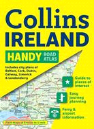
Complete with information on places of tourist interest, this handy format route planning atlas in full color also features fully indexed town center plans of Belfast, Cork, Dublin, Galway, Limerick,
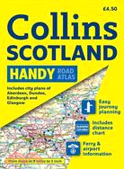
Clear, attractive route planning maps of the whole of Scotland are supported by comprehensive, fully indexed city center street maps of Aberdeen, Dundee, Edinburgh, Glasgow, Inverness, and Perth. Thes
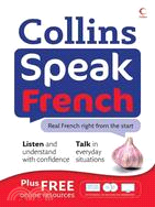
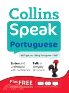
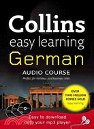
Divided into 12 short units, this easy-to-use language course with three audio CDs will help beginners speak with fluency and ease. Each unit introduces five key words and phrases before expanding int
This contemporary and fresh reference is divided into three sections that encourage an understanding of the language beyond memorizing simple phrases. The first section presents full, natural conversa
The next step in the Easy Learning Audio series, this CD-based course expands on the knowledge gained in the more basic course, enabling learners to converse at a higher level and with greater confide
This classic collection contains 1,000 hymns and choruses on a wide range of themes. It has been a much-loved resource in thousands of churches in the last century and is still widely used around the
With a scale of 4.25 inches to 1 mile, this handy full color?atlas?has clear street level mapping presented in an easy to use handy format.?Features include?a route-planning road map of the area aroun
This contemporary and fresh reference is divided into three sections that encourage an understanding of the language beyond memorizing simple phrases. The first section presents full, natural conversa
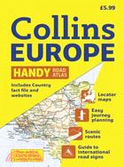
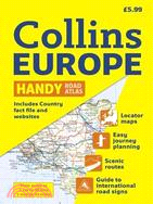
A handy format road atlas of Europe at 34 miles to 1 inch with lie-flat spiral binding, ideal for both?drivers and those traveling by public transport??Every major European country is covered in this
Compiled by the editor of London's?The Times crossword, this original compilation will challenge even the most experienced crossword buff. With unique grids of 23 x 23 squares?larger than the standard
Fully revised, this spiral road atlas contains road mapping, route planning maps, larger scale road maps of the Ruhr and Rhine, city through route maps, city center plans, and a comprehensive place na
This road atlas with popular lie-flat spiral binding features clear, detailed road mapping, at a scale of 3.2 miles to 1 inch, with land height shown by attractive layer coloring. There are also a wid
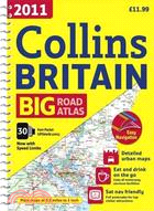
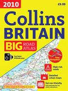
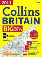
The ultimate 3.2 miles to 1 inch scale large format road atlas for the year 2011 features Collins' popular and well-established road mapping, designed for exceptional clarity.?A wide range of urban ar
Divided into 12 short units, this easy-to-use language course with three audio CDs will help beginners speak with fluency and ease. Each unit introduces five key words and phrases before expanding int
Divided into 12 short units, this easy-to-use language course with three audio CDs will help beginners speak with fluency and ease. Each unit introduces five key words and phrases before expanding int
Divided into 12 short units, this easy-to-use language course with three audio CDs will help beginners speak with fluency and ease. Each unit introduces five key words and phrases before expanding int
This contemporary and fresh reference is divided into three sections that encourage an understanding of the language beyond memorizing simple phrases. The first section presents full, natural conversa
This contemporary and fresh reference is divided into three sections that encourage an understanding of the language beyond memorizing simple phrases. The first section presents full, natural conversa
The ultimate 3.2 miles to 1 inch scale large format road atlas for the year 2010 features Collins' popular and well established road mapping, designed for exceptional clarity.?A wide range of urban ar
The Collins Spurrell Pocket Welsh Dictionary offers the user excellent coverage of today’s language. Color layout and clear presentation of information make this compact book ideal for all English and
Ideal for pocket or purse, this handy little street atlas covers a large area of central London at a clear and easy to read scale. The pages have striking colored page edges to highlight the different
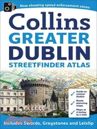
Scale 4 inches to 1 mile, this street mapping of Greater Dublin?is fully indexed. Fixed safety cameras have been added as well as Speed Enforcement Zones, which highlight roads that have been?identifi
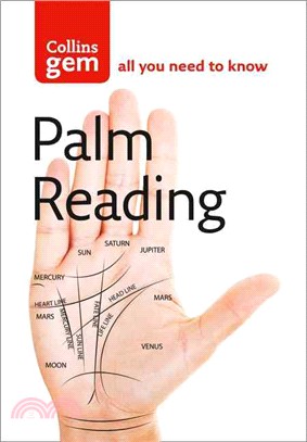
With easy-to-follow diagrams accompanying clear and concise text, this book lays bare the complexities of hand reading. The book provides an introduction to how to read palms so that a beginner will s
Incredibly detailed street level maps, with?more than?40 categories of information, cover 1,660 square miles in and around London.?Extra large scale central London maps at 6.3 inches to 1 mile make fo
This updated?guide?includes such essential information as emergency contact numbers; the best way to get around; the best places to shop and visit; where to go for live music, the cinema, and concerts
This contemporary and fresh reference is divided into three sections that encourage an understanding of the language beyond memorizing simple phrases. The first section presents full, natural conversa
Covering a wealth of fascinating subjects, this remarkable reference provides A-to-Z entries along with a variety of engrossing illustrations. Ranging from alphabets and musical symbols to weapons and
Presented with lie-flat spiral binding, this is the ultimate 3.2 miles to 1 inch scale large format road atlas for the year 2010. Collins' popular and well established road mapping is designed for exc
Fully updated, this atlas features?maps of Britain at 9.9 miles to 1 inch and the whole of Ireland is covered at 15.8 miles to 1 inch. There?is also a selection of more detailed urban area maps at 4.5
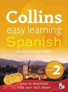
The next step in the Easy Learning Audio series, this CD-based course expands on the knowledge gained in the more basic course, enabling learners to converse at a higher level and with greater confide
Maps in this atlas?are exceptionally clear and easy to use with color coding for both the roads as well as locations such as?shops, hospitals, hotels, schools, and more.?They include postal district b
This handy little atlas features high quality Collins mapping. A huge amount of detail is contained within the mapping without compromising the clarity. Central London is mapped at a larger scale. Sca
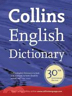
Marking the 30th anniversary of the first edition's publication,?this new edition is updated with the latest terms to enter the English language. Comprehensive and authoritative,?this reference?also o
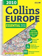
Every major European country is covered in this fully updated road atlas that features a ratio of 34 miles to one inch. Euroroutes and highways are clearly identified as are all international road cla
Also available nonlaminated, this world map is perfect for an classroom, bedroom, or office wallA new and updated laminated edition, this ideal reference map covering the whole world shows the politic
The ultimate 3.2 miles to 1 inch scale large format road atlas for the year 2011 features Collins' popular and well-established road mapping, designed for exceptional clarity.?A wide range of urban ar
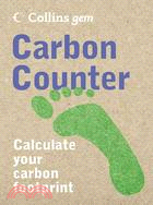
Covering everything from gas and electricity usage to the carbon cost of shipping in exotic foods, this handy green calculator provides all the tools you need to calculate your daily impact on the en
Divided into 12 short units, this easy-to-use language course with three audio CDs will help beginners speak with fluency and ease. Each unit introduces five key words and phrases before expanding int
Divided into 12 short units, this easy-to-use language course with three audio CDs will help beginners speak with fluency and ease. Each unit introduces five key words and phrases before expanding int
Divided into 12 short units, this easy-to-use language course with three audio CDs will help beginners speak with fluency and ease. Each unit introduces five key words and phrases before expanding int