Fully updated road mapping covers the whole of Britain, with each scale of mapping color-coded for ease of use The ultimate 3.2 miles to 1-inch scale, large-format road atlas for the year 2012 feature
Fully updated road mapping covers the whole of Britain, with each scale of mapping color-coded for ease of use The ultimate 3.2 miles to 1-inch scale, large-format road atlas for the year 2012 feature
A new and extended edition of a vital tool for students, with new topics including world agriculture, world climate change, low and middle economic developing countries, and?ecological footprint?Altho
A collection of extremely clear, route-planning maps of Britain and Ireland that fits neatly into the glovebox, pocket, or bagThis handy road atlas makes for the ideal traveling companion. The maps of
Highly detailed maps give balanced worldwide coverage, while beautifully illustrated thematic pages and thousands of facts and statistics enable the user to know the worldPerfect for family reference,
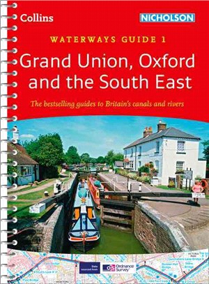
This popular guide covers the canals and waterways between Birmingham and the River Medway. Colour Ordnance SurveyR maps clearly show locks, towpaths, and boating facilities. There are also comprehens
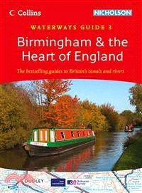
This popular guide covers the canals and waterways around Birmingham and central England. Color Ordnance SurveyR maps clearly show locks, towpaths, and boating facilities. There are also comprehensive
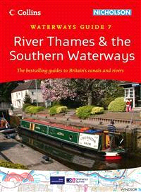
This popular guide covers the canals and waterways between Exeter and the River Thames. Colour Ordnance SurveyR maps clearly show locks, towpaths, and boating facilities. There are also comprehensive